|
|
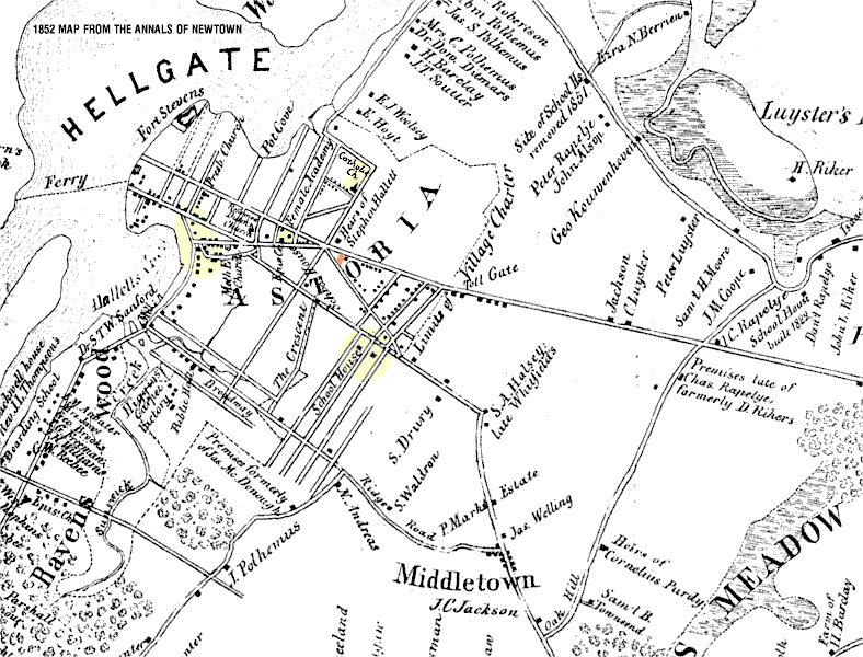
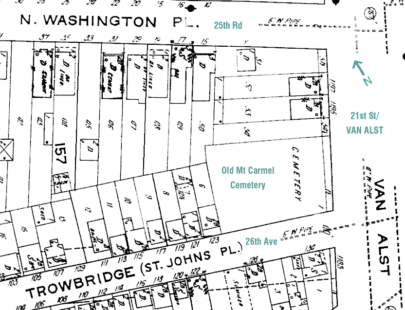
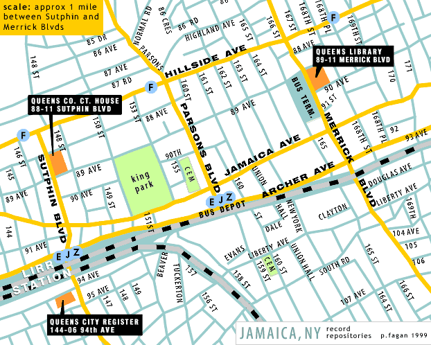
I hope to post more of these maps as I scan then. Most of my sources are very bad microfilm printouts made at the NYPL, Preparation has been laborious. • Hallets Cove, 1840 • Newtown - 1852 The Astoria portion of the the foldout map from "The Annals of Newtown". The ORANGE area is the current location of Our Lady of Mt Carmel. • 1873 map A section of western Astoria, ca. 1873. Nancy Lutz has posted the entire map (Long Island City) on her Brooklyn Information page - maps page. • Also from Nancy's site, some 1873 maps of particular interest to researchers of western Queens: Long Island City (overview of all of western Queens) | Ravenswood detail | Astoria detail | East Astoria detail • 1890 Astoria A small section of Astoria, ca. 1890, southeast of Our Lady of Mt Carmel • Hallets Cove, northern half, ca. 1890 • Hallets Cove, southern half, ca. 1890 • Mt. Carmel Cemetery The old graveyard of the Church of Our Lady of Mt. Carmel, in Astoria, Queens. Plot map and inscriptions (as yet incomplete). Sanborn Insurance Map details - Queens, Vol 2 (Astoria) • Map 14 - Mount Carmel Cemetery area - ca. 1919(58k) Other Queens Maps • Calvary Cemtery Scans of plot maps of Calvary Cemetery, Woodside, Queens, NY. • Jamaica Map (43k) A map of my own. Three of the main Queens genealogical repositories are located within (roughly) a square mile of Jamaica. This map shows locations and transportation. • For more information see Queens Co. Genealogical Resources -> repositories -> queens |
top page
Apr 2005 - Patty Fagan pfagan@compuserve.com